Introduction:
The forest park of Kunkilling is located in a village called Kerr Serrekunda on the southern
bank of the River Gambia, opposite the eastern end of Janjangbureh
island, and within 10 minutes by car of Sankulay Kunda. Its geographical
coordinates are N 13° 31' 28'' W 14° 42' 0''.
is located in a village called Kerr Serrekunda on the southern
bank of the River Gambia, opposite the eastern end of Janjangbureh
island, and within 10 minutes by car of Sankulay Kunda. Its geographical
coordinates are N 13° 31' 28'' W 14° 42' 0''.
An excellent example of riverine type woodland has in recent years
been set up as a conservation area.
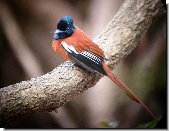
The area is well worth paying a visit for bird
watching where you can spot red-necked falcons perching on
the rhun palms and African finfoots scratching around for food
around the screw pine trees. Other species includes Adamawa Turtle
Doves and the Banded Martin.
There is a fee to enter the Kunkilling Forest and tickets are
available from the Gambia's Forestry Division office on the north
island. They can be reached on tel: 567 6200.
|
|
 Attractions
Nature
Reserves
Resorts
 Abuko Nature Reserve
Ballabu
Conservation
Bama
Kuno Forest
Bao
Bolong Wetland
Bijilo
Forest Park
Bolong
Fenyo
Kiang
West
Kunkilling
Forest Park
Makasutu Cultural Forest
Niumi
National Park
Pirang
Forest
River
Gambia Park
Tanbi
Wetlands
Tanji
Bird Reserve
Tumani
Tenda

|