Introduction:
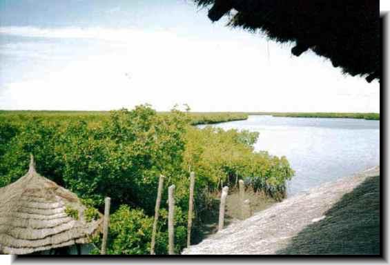
 The
wilderness site of the Tanbi Wetland Complex, in Gambia, is located
just on the southern entrance to the mouth of the River
Gambia. It covers a total area of about 6,000 hectares
(of which mangroves make up 4,800 hectares) and its widest expanse
is located to the west and south west of Banjul.
Tanbi's northern most point skirts the (Bund) Kankujeri Road of
Banjul and also includes Cape Creek. It encompasses the fringes
of the island of St. Mary at its Atlantic Ocean side and down
south east towards Lamin and Mandinari Village. It was declared
a Ramsar site
in February, 2007. This is an international convention for the
preservation of wetlands and its natural resources. The
wilderness site of the Tanbi Wetland Complex, in Gambia, is located
just on the southern entrance to the mouth of the River
Gambia. It covers a total area of about 6,000 hectares
(of which mangroves make up 4,800 hectares) and its widest expanse
is located to the west and south west of Banjul.
Tanbi's northern most point skirts the (Bund) Kankujeri Road of
Banjul and also includes Cape Creek. It encompasses the fringes
of the island of St. Mary at its Atlantic Ocean side and down
south east towards Lamin and Mandinari Village. It was declared
a Ramsar site
in February, 2007. This is an international convention for the
preservation of wetlands and its natural resources.
Flora & Ecosystem:
 Eighty
per cent of the Tanbi Wetland Complex is composed of forest wilderness
is made up of several species of mangroves which includes the
Avicennia africana, Alder Conocarpus, Laguncularia racemosa, Annona
glabra and the Rhizophora with the occasional Baobab
or rhun palm standing on more solid
earth. Vegetation gradually changes to bare flats, salt marsh,
and dry woodland or grass woodland to the west and south, with
agricultural uses in the bordering zones. The natural vegetation
is laced in a patchwork of tidal creeks (bolongs), lagoons Eighty
per cent of the Tanbi Wetland Complex is composed of forest wilderness
is made up of several species of mangroves which includes the
Avicennia africana, Alder Conocarpus, Laguncularia racemosa, Annona
glabra and the Rhizophora with the occasional Baobab
or rhun palm standing on more solid
earth. Vegetation gradually changes to bare flats, salt marsh,
and dry woodland or grass woodland to the west and south, with
agricultural uses in the bordering zones. The natural vegetation
is laced in a patchwork of tidal creeks (bolongs), lagoons and estuarial saline mudflats. It plays a key role in water retention
of the area as it acts like a giant natural sponge for rainwater
and tidal river flows as well as to stabilise the shoreline.
and estuarial saline mudflats. It plays a key role in water retention
of the area as it acts like a giant natural sponge for rainwater
and tidal river flows as well as to stabilise the shoreline.
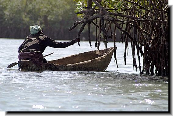
Human encroachment & activities:
The main activities in and around the complex are shrimp fishing,
vegetable gardening and rice growing.
During the dry season, a small number of Jola
women collect, roast and sell oysters harvested from the mangroves
located on the site. Firewood is also collected from the
area making it possible for these women to burn the oysters as
well as to cook their meals.
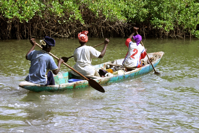
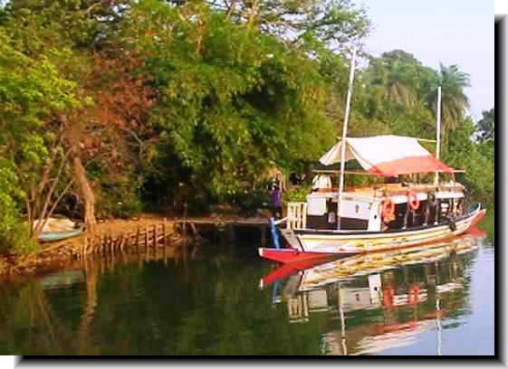
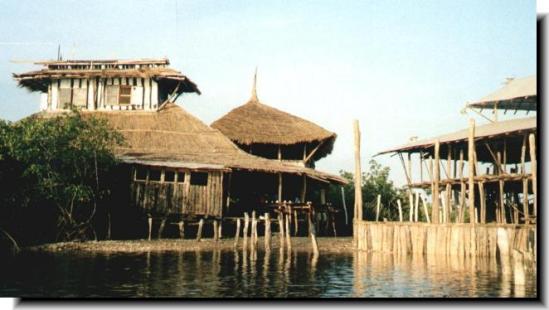
 There
are also industrial warehouses and tourist fishing
boats offering trips along the Oyster Creek from Denton
Bridge, down south to the Daranka Bolong, and out towards
the estuary and Lamin Lodge at the Daranka Channel. There
are also industrial warehouses and tourist fishing
boats offering trips along the Oyster Creek from Denton
Bridge, down south to the Daranka Bolong, and out towards
the estuary and Lamin Lodge at the Daranka Channel.
Fauna:
Among the animals to be found on the site are small monkeys, crocodiles,
lizards as well as threatened or endangered species associated
with mangrove swamps. These are the West African manatee, Pel’s
fishing owl, African Clawless otter, brown-necked parrot
and the Western Red Colobus. Climate change and global warming
pose a particular threat to wildlife
in the wetlands as sea levels rise.
Avifauna:
 The
number of bird species so far
recorded on the site is just over 360. Among the birdlife are
the Grey-headed Gull, Ospreys, Western Reef-egret, Sacred Ibis,
Malachite Kingfishers, Black-tailed Godwit, Blue-bellied Roller,
Caspian Tern, Pigmy Sunbird, Red-necked Falcon, Rufous Crowned
Roller, pelicans and storks. The
number of bird species so far
recorded on the site is just over 360. Among the birdlife are
the Grey-headed Gull, Ospreys, Western Reef-egret, Sacred Ibis,
Malachite Kingfishers, Black-tailed Godwit, Blue-bellied Roller,
Caspian Tern, Pigmy Sunbird, Red-necked Falcon, Rufous Crowned
Roller, pelicans and storks.
Geographical coordinates: 13°26’N and 16°38’W. |
|
 Attractions
Nature
Reserves
Resorts

 Abuko
Nature Reserve Abuko
Nature Reserve
Ballabu Conservation
Bama Kuno Forest
Bao Bolong Wetland
Bijilo
Forest Park
Bolong Fenyo
Kiang West
Kunkilling Forest Park
Makasutu Cultural Forest
Niumi National Park
Pirang Forest
River Gambia Park
Tanbi Wetlands
Tanji Bird Reserve
Tumani Tenda

 |